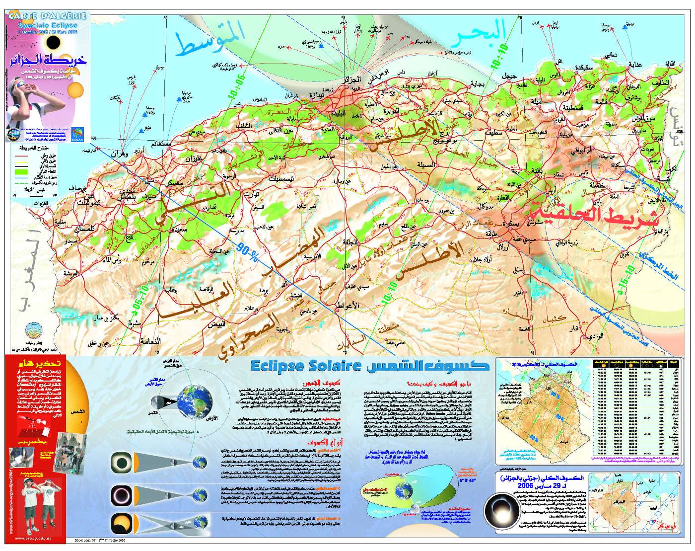
Une
carte de l'Algérie du Nord grand
format Spécial Eclipse a été réalisée
par notre Association en collaboration
avec le CRAAG
et sous la maitrise d'oeuvre de l'INCT.
Elle est disponible depuis le 15 Septembre courant. Cette carte
grand public de 100cmx80cm contient superimposée aux
données topographiques, routières et administratives,
la bande de totalité et les différents lignes
d'iso-obscuration avec les instants de passage. Elle a été
distribuée bénévolement par notre Association
dans les differents établissements publics, scolaires,
religieux, et administratifs. Elle est aussi en vente à
un prix subventionné pour le public. Demander la à
votre libraire. Pour tout distributeur intéressé,
veuillez nous contacter.
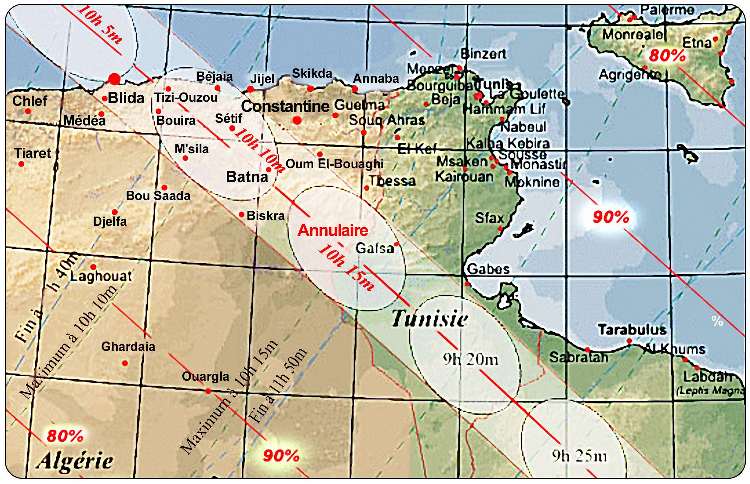
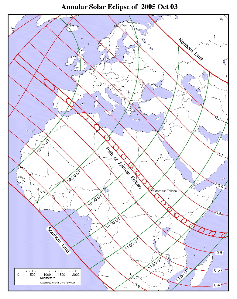
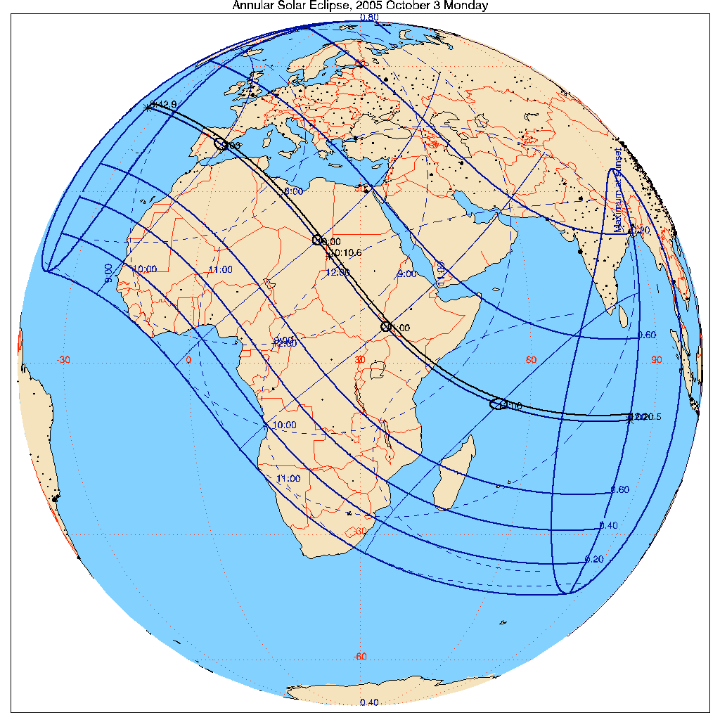
Map of theTuniso-Algerian region concerned by the eclipse. From the
imcce site, adapted and corrected.
More maps of the eclipse path at the site itself.